The invention of GPS and navigation systems has certainly made life and traveling easier.
In this article, we will present the technological possibility of GPS navigation permanently installed in passenger cars and answer the question of how to take care of our navigation so that it serves us well and without problems.
Road Navigation thanks to GPS Receivers and map software
GPS, or Global Positioning System, is a satellite navigation system for determining the user’s position in the field. The inventor and developer of GPS is the United States Department of Security, which initially aimed to create a location system used only for military purposes.
Thanks to the development of technology and the distribution of satellites around the globe, GPS enables real-time location determination with accuracy down to a few meters. Its greatest advantage is accessibility all over the world and resistance to any interferences, such as from weather conditions.
How does GPS work?
The system reads the signal sent by the satellite, determined by coordinates. GPS has been used in many fields, not only military, but also civil – especially in new technologies. The work of satellites is used by archeology, mining, meteorology, rescue and order services, railway, air and road transport, and shipping. The functionality of the system allowed it to be used in everyday objects, such as telephones, watches, tablets, animal wristbands and of couse inside our daily cars.
How GPS can be used for navigation and guiding on road
Since we already know that the GPS system itself is only used to determine our current position in space, a question may arise – how does GPS navigation work?
The key to understanding how a navigation system can guide us is that the GPS receiver itself is only part of a larger system and is useless for navigation without an up-to-date database.
The navigation system consists of:
- GPS receiver
- Database containing the road network and their connections – popularly known as GPS maps
- Specialized software that can calculate the route and generate directions in real time
In order for the navigation system to work properly, the road database must be up-to-date - and therefore in line with reality.
If any road is closed or another alternative route is created - the database of the linkage network must be updated.
If the navigation system does not have an up-to-date map, it may be more harmful than aiding your journey.
Let’s get back to the essence of GPS navigation system principals and look what are the key aspects of it.
Searching for destination
We usually start using navigation system from setting the destination point.
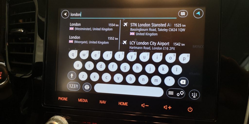
When in our navigation we search for the destination address to which we want to reach, we usually enter the postal address – the database is queried and the results are presented on the screen.
When the found location meets our needs – click “go to” or a similar command like “drive to” on the screen.
At this point, a very complicated process begins, during which the algorithm of using the road information database will guide us on the optimal route.
If we did not have such a device – we would lay out the route ourselves, having at our disposal paper or electronic maps.
However, the greatest advantage of the GPS navigation system is the fact that the mapped route will be much better than that planned by a human – of course, provided that the database (map) on which the route is based is up-to-date.
Postal address to GPS coordinates mapping
It is worth noting that the GPS satellite system itself knows nothing about postal addresses.
GPS uses the coordinates of latitude and longitude, which are usually presented in the form of 2 numbers with with multiple decimal places.
Handling such technical position information is for sure very inconvenient.
To search for addresses used by people, i.e. city name, street, building number – navigation database must link the physical address with GPS coordinates.
Below we have presented some famous places and their corresponding GPS coordinates in numerical form.
| Location name | Location address | Place GPS Coordinates |
| Buckingham Palace | Buckingham Palace Road London SW1A 1AA, United Kingdom | 51.50147751667181, -0.14189000151342254 |
| The White House | 1600 Pennsylvania Avenue NW, Washington, DC 20500, United States | 38.89786832738777, -77.0365298018348 |
| Sydney Opera House | Bennelong Point, Sydney NSW 2000, Australia | -33.85656164095402, 151.2151786810901 |
In order for the accurate translation of physical addresses to Latitude and Longitude , the navigation system must also have up-to-date information on the names of streets, cities and buildings.
That is why it is so important that our navigation has up-to-date databases – both the address database and the road network.
Real time on-road navigator directions
When the GPS system has received our starting (current) location from the GPS satellites using the receiver and determined the coordinates of the destination – the core navigation process begins.
On the screen and thanks to of voice speech , commands are given – e.g. “drive straight”, “turn left”, “cross roundabout – second exit”.
When we are on the move – the GPS receiver continuously receives its position on an ongoing basis and compares it with the planned route.
When we approach a roundabout, an intersection or a junction – it informs us which way to choose – by voice command and screen symbol.
If we make a mistake, the system may give you an alternative route or suggest you to turn back until we reach the final destination of our trip.
GPS System – types
At the beginning of their career, GPS navigation devices were produced and sold in the form of dedicated portable devices that could be installed in a car, yacht or bicycle.
Over time, car manufacturers began to create integrated navigation systems in their multimedia systems so that there was no need to use additional screens, cables and mounting brackets.
Today, many navigation systems rely on smartphone applications. This is possible due to the fact that modern smartphones have a hidden GPS receiver inside.
In the following, however, we will focus on the navigation built into the car system.
In-car GPS navigation system
The new car equipped with factory navigation looks great. However, there is a price to pay for comfort and luxury. Until recently, built-in navigation in a car was associated with a luxury that only the richest could afford. It is now becoming almost a standard. However, is it really worth investing an extra thousand dollars, the equivalent of which can be installed on a smartphone for free?
When GPS navigation system was installed for the first time in car?
It is hard to belive but over 30 year ago – in 1990, Mazda’s Eunos Cosmo was the first production car in the world with a built-in GPS navigation system.
In 1991, Mitsubishi introduced GPS car navigation on the Mitsubishi Debonair (MMCS: Mitsubishi Multi Communication System). In 1997, a navigation system using Differential GPS was developed as a factory-installed option on the Toyota Prius.
Today GPS Receivers and Navigation software mounted in series car are nothing spectacular. We use them for so many year that almost everybody considers them as must-have accessory for new car.
Prestige and comfort
One of the undeniable advantages of the built-in car navigation solution is the feeling of uniqueness and prestige accompanying the owner of the vehicle. The clearly visible navigation screen makes the car look more luxurious, and thus more expensive.
The price of the car is another plus of having built-in navigation. Although when buying a new car you have to invest in it sometimes quite a lot of money, when selling this car it will also be several thousand more expensive than the same model without factory navigation.
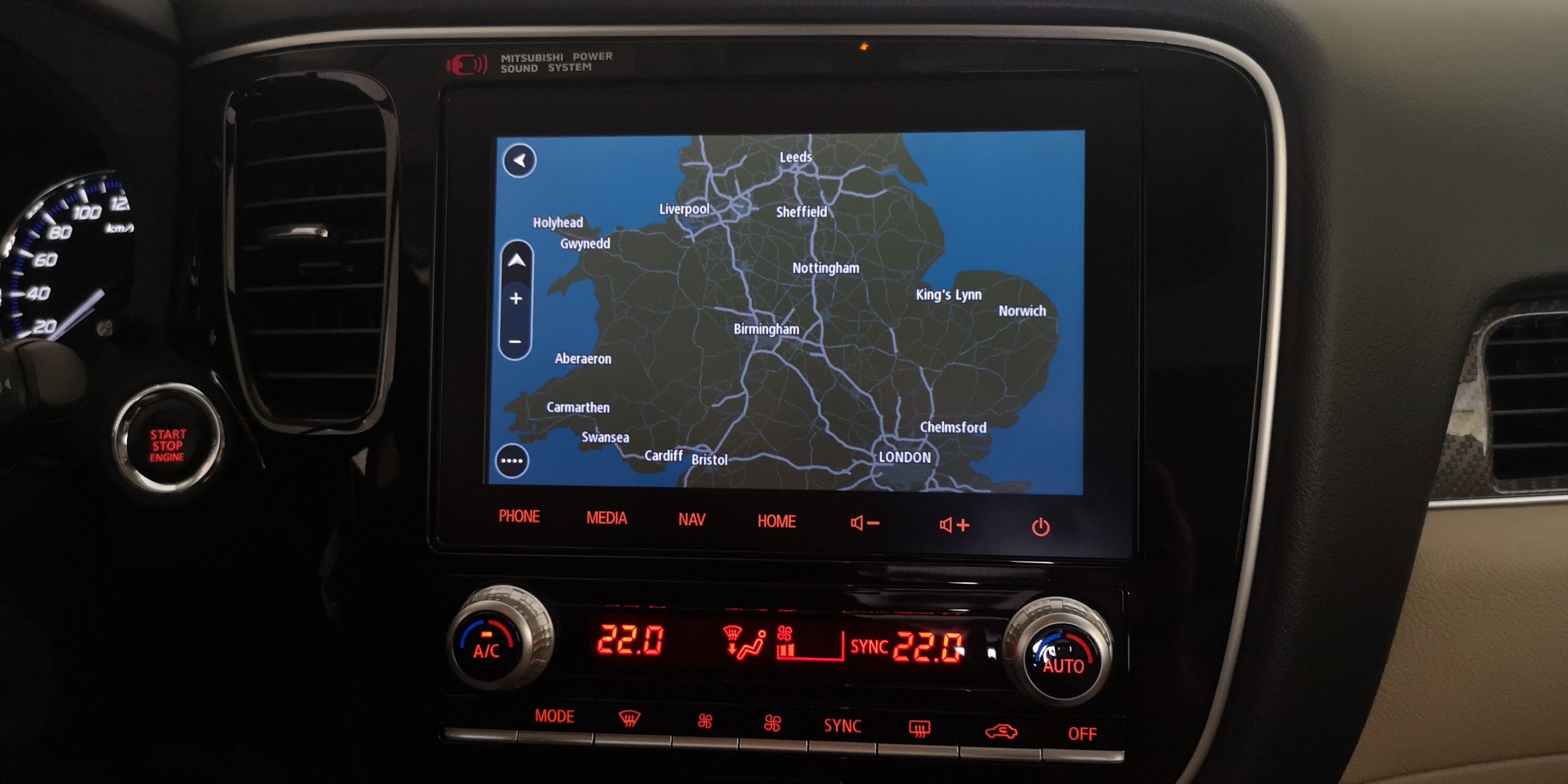
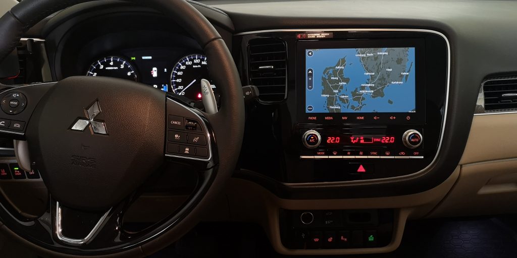
One of the main reasons for choosing built-in navigation is the convenience of its use. Most manufacturers place the navigation screen in the center of the cockpit, making it perfectly visible. Such a solution has, among others Mitsubishi navigation system. This location is optimal for both the driver and the passenger. In addition, the factory navigation can usually be operated using buttons or paddles located on the steering wheel, which significantly increases the comfort and safety of driving.
Price and Updates
The new car equipped with factory navigation looks great. However, there is a price to pay for comfort and luxury. The cost of installing factory-installed navigation in a new car sometimes seems disproportionate to the profits that can be obtained from using it.
The biggest problem with factory navigations is the up-to-date map data. Taking into account the dynamic development of road infrastructure not only in Europe but also in the world, road maps should be updated on a regular basis. While in the latest car models the problem has been solved by the installation of navigation with Internet access, so the “older” models and those purchased in the budget version (with less extensive equipment) have to be updated by yourself.
Uploading the current map to the factory navigation is another cost related to the use of the car. The problem does not end there, because maps that can be purchased from manufacturers are often outdated at the time of purchase. Manufacturers update their maps up to twice a year, so the maps may not contain some important roads.
The process of updating the map may seem difficult. However, with a little patience, we can do it ourselves.
The database of places and road network can be saved in many ways.
- CD
- SD card
- USB flash drive
- WIFI connection
- Permanent Internet connection (SIM card)
Currently, producers have given up on CDs and are rather moving away to SD cards.
A USB flash drive is an increasingly common delivery mechanism for the updated database.
Many car manufacturers have provided us with free upgrades for my moms for several years after the car was purchased.
Below is a video tutorial on how to update GPS maps in new Mitsubishi cars:
Is it worth it or not?
There is no good answer to the question of whether it is worth buying a factory-fitted navigation device. In the case of a new car, the additional cost of this equipment can reach up to several thousand dollars.
Before making a decision, it is worth checking the issues related to the map updates offered by the manufacturer and the cost of these updates. The factory navigation is undoubtedly a decoration of the car interior and a symbol of luxury. However, the standard version of navigation, without internet connection, becomes much less useful than the online navigation that almost every smartphone now offers.